EscautSchelde2050


Cross-border cultural, scientific and touristic cooperation around the Scheldt region, calling the attention to the importance of sustainable management.
Reading summaries SCHELDT Congres October 2017
1. Introduction
•Building with History: heritage and river development
Prof Dr Tim Soens, Department Medieval and Environmental History at the University of Antwerp
PhD on the History of Coastal Water Management and Flood Protection in Medieval Flanders,
Head of research team on the Environmental and Rural History of Urbanized Societies (ENVIRHUS)
The River Scheldt is History. Situated in the urbanized core of North-Western Europe, the river Scheldt not only played an important role in the economic, political and cultural development of the Low Countries, but she was also continuously shaped and transformed by farmers, cities, princes, boatsmen, states, and all those generations of people which day-to-day interacted with the river for their livelihood, their entertainment or their safety. Their efforts, plans and dreams are still concealed in the soil and landscape of the Scheldt Region, waiting to be discovered. Along the river, we find some of Europe’s most precious historical landscapes, from the polders near the estuary over the wetlands along the upper stretches to the river ports in historic cities from Cambrai over Ghent and Antwerp to Vlissingen and Breskens. These historical landscapes testify of the way previous generations have interacted with the river, used its sediment and water for their benefit, or protected themselves against occasional floods. In this contribution we aim to show not only the historic variety and the richness of the riverine landscape, but also its unique potential for future developments. Better integrating the history of the river and the landscapes shaped by the river in future developments (from agriculture and industry over flood protection to nature development) can be an important asset, economically, ecologically, esthetically and socially. We will illustrate this view with examples from both the Scheldt Polder Area north of Antwerp and the region between Ghent and Oudenaarde.
•Ganda en Blandinium at the River Scheldt in Ghent
Johan Van de Wiele, historian
Head of Department Culture, Sport and Leisure Ghent - Departementshoofd Cultuur, Sport en Vrije tijd stad Gent
Most historians believe that the older name for Ghent, 'Ganda', is derived from the Celtic word ganda which means confluence (in this case from the River Scheldt and Leie. Around 650, two abbeys were founded by the Holy Amandus in Ghent : St. Peter's (Blandinium) and St Bavo's (Ganda) . The city consisted of several nuclei that finaly connected by extending : the abbeys and a commercial centre. Around 800, Louis the Pious, son of Charlemagne, appointed Einhard, the biographer of Charlemagne, to be the abbot of both abbeys. In 851 and 879 however, the city was attacked and plundered twice by the Vikings. Within the protection of the County of Flanders, the city recovered and flourished from the 11th century, growing to become a small city-state. The castle of the Dukes of Flanders has been preserved and open for visiting. A lot of land was periodically flooded by the river and creatde fertile land. These rich grass wetlands (Scheldemeersen) were suitable for herding sheep and their wool. During the Middle Ages Ghent was the leading city for cloth. The wool industry, originally established at Bruges, created the first European industrialised zone in Ghent in the High Middle Ages. The mercantile zone was so highly developed that wool had to be imported from Scotland and England. This was one of the reasons for Flanders' good relationship with Scotland and England. Charles V, Emperor of the Holy Roman Empire and King of Spain was born in Ghent in 1500. Although native to Ghent, he punished the city after the 1539 Revolt of Ghent and obliged the city nobles to walk in front of the Emperor barefoot with a noose (Dutch: "strop") around the neck. The Saint Bavo Abbey was abolished and replaced with a fortress for Royal Spanish troops.
In the 18th and 19th centuries, the textile industry flourished again in Ghent. Lieven Bauwens, having smuggled the industrial and factory machine plans out of England, introduced the first mechanical weaving machine on the European continent in 1800. The port of Ghent, in the north of the city, is the third largest port of Belgium. It is accessed by the Ghent-Terneuzen Canal, which ends near the Dutch port of Terneuzen on the Western Scheldt. The port houses, among others, large companies like ArcelorMittal, Volvo Cars, Volvo Trucks, Volvo Parts, Honda, and Stora Enso.
The Ghent University and a number of research oriented companies, such as Ablynx, Innogenetics, Crop design and Bayer Cropscience, are situated in the central and southern part of the city.
.
2.Upstream the River Scheldt
•The River Scheldt from source to mouth
Prof Dr Patrick Meire, Chair of the Department of Biology, University of Antwerp, Chair of Ecobe
Writer of the Book 'De Schelde van bron tot monding' and many others.
The River Scheldt is a fascinating river with a long and interesting history. She originates in Gouy in France and flows through Valenciennes, Tournai, Oudenaarde, Ghent and Antwerp to Vlissingen, where she ends up in the North Sea after a journey of 360 kilometers. The many aspects of the river as we know them today are the result of an age-long interaction between man and nature. In addition, many have roots in history, sometimes even in a very distant past. Sediments were deposited many millions of years ago when our regions were flooded by the then sea. They form the stones that were used to build many buildings such as churches in the Scheldt Gothic and some are now the foundation for the cement industry. The lush plant growth in vast marshes became the coal that was at the root of the industrial revolution.
The Schelde has traditionally been an important transport route and has been continually adapted and supplemented with an extensive network of channels over the centuries. Several ports developed along the borders of the River Scheldt of which Antwerp is undoubtedly the most important. Among other things, the Schelde region was and is very prosperous despite the many wars and setbacks. This wealth is reflected in a rich cultural heritage.
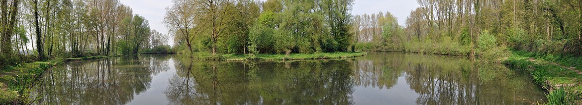
Although the impact of humankind and the economic development on the Schelde natural system is large we can still find many natural beauties along its entire course. Many of these are precisely the result of human activities such as marshes caused by mining. Especially along the Zee- and Westerschelde where the tide are dominant there are unique natural areas.
Good knowledge must also be the base of future management. Climate change and socio-economic developments require major decisions and measures. We therefore argue for an integrated management of the entire River Scheldt targeting sustainable development : the River Scheldt as a laboratory for sustainable development.
•2.1 Around the River Scheldt in France : the history of Flandre-Hainaut
Maryse Boudard, Chair of AGFH,
Présidente de l'Association Généalogique du Flandre-Hainaut.
The Historical Genealogical Association of Flanders-Hainaut (A.G.F.H.) studies Genealogy and local History, their offices are located at the borders of the River Scheldt in Valenciennes.
Upstream the River Scheldt the Abbey of Vaucelles, an old Cistercian abbey, was founded in 1132 by Saint-Bernard, it was a daughter-house of Clairvaux. The 12th century claustral building is the only remains of this immense abbey, now open to the public. It included the Norman scriptorium, auditorium, chapter room (built in 1170). Vaucelles is the largest Cistercian chapter room in Europe and the acoustics are exceptional. Valenciennes is situated at the River Scheldt in Northern France, it was first mentioned in 693 by Clovis II (Valentiana). In the 843 Treaty of Verdun, it was made a neutral city between Neustria and the Austrasia. Later in the 9th century the region was overrun by the Normans. In 923 Valenciennes became the center of marches, on the border of the German Holy Empire.The River Scheldt was the natural frontier with France at that time. In 1008, a terrible famine brought the Plague. According to the local tradition, the Virgin Mary held a cordon around the city which, miraculously, has since protected its people from the disease. Valenciennes became an early center of Calvinism and in 1562 was location of the first act of resistance against persecution of Protestants in the Spanish Netherlands. On the "Journée des Mals Brûlés" (Bad Burnings Day) in 1562, a mob freed some Protestants condemned to die at the stake. When for a time the Southern Netherlands joined the revolt, the Spanish forces massed at the porte d'Anzin (in a fortress known as "La Redoute") were besieged by Valenciennes. However, in 1580, Alexander Farnese, Duke of Parma took Valenciennes and Protestantism was eradicated there. In the seventeenth century the Scheldt was channelled between Cambrai and Valenciennes, benefitting Valenciennes' wool, fabric and fine arts. To use up flax yarn, women began to make the famous Valenciennes lace. The armies of Louis XIV of France (led by Vauban) captured the city and in 1678 the Treaty of Nijmegen gave the French control of Valenciennes (1678) and the surrounding southern part of Hainaut, roughly cutting the former county in half. The city became one of the main strongholds of northern France, and was fortified by Vauban, who personally visited the town for that purpose shortly after the Treaty. In the 18th century the discovery of coal led to the formation of the Compagnie des mines d'Anzin, the city was renowned for its porcelain — indeed, it was the porcelain furnaces' demand for coal that led to the mining enterprises. In the 19th century, thanks to coal, Valenciennes became a great industrial centre and the capital of Northern France's steel industry. The landscape around the River Scheldt witnesses this industrial past and with the Parc Naturel the l’Escaut and the trans-border Planes of the River Scheldt, these precious grounds were classified as natural reserves.
•The Scheldt : A geo-historical link between France and Belgium
Prof Eric Masson, Associate Professor University of Lille Sciences and Technologies, Geography and Urban Planning.
Espaces et données numériques du patrimoine culturel : topologies et topographie des itinéraires culturels, le cas de la Via Francigena (PEPS Geriico, EPFL, CLERSE, IRHIS, Universités de Bologne et d'Amsterdam).
By analyzing the territorial issues and environmental impacts at the local and transnational levels, based on the Riqueval and Chabaud-Latour sites we get a geo-historical perspective between France and Belgium upstream of the Scheldt basin. The historical analyze of the managements and the infrastructures of both sites may indeed help to understand the environmental problems that arise when the Directives of Water Management (DCE) are applied for the construction of the Seine-Nord canal. Industrial and post-industrial recovery of the transboundary mining basin testify of the weight of inheritance in the current and future management of development of post-industrial environmental constraints in a cross-border perspective on the scale of the Scheldt. Consequences of the end of the mining activity: 384 hectares of brownfields. The Chabaud-Latour lagoon shows the zone of mining activity, subsidence of 5 to 10m depending on the sectors, creation of 150 hectares of subsidence wetlands. In 1994 the restauration of the site (Europe & NPDC region) was organised with the plantation 200 000 trees and 400 000 shrubs, 34 km of walking paths and 2 nautical bases. Hydraulic pumps against flooding were installed. In 2012 the reserve was classified as a UNESCO World Heritage site.
•Geo-history of landscape transformation in the Upper Scheldt Valley from the 12th till the 21st century.
Laetitia Deudon, University Valenciennes France
PhD Student in environmental history and geohistory, Research about riverscapes metamorphoses in Europe and North America through the comparative analysis or Scheldt Valley and St. Lawrence Valley.
While the Scheldt Valley takes part in important regional projects in an international perspective (Canal Seine-Nord-Europe, Parc naturel transfrontalier du Hainaut, Ramsar label, Man & Biosphere Unesco’s Project), the story of this European river has to be rewritten in a long term approach to understand its contemporary landscapes, producted by successive managements over centuries. This presentation fits in the PhD study in Environmental History, which deals with the geohistory of riverscapes transformations in the Scheldt valley (Cambrai-Tournai) through the study of hydraulic managements and uses (navigation, military and mining activities, fish farming, milling, agro-pastoral uses) which help to inderstand the shape of the valley nowadays. The aim is to compare past and present data, the Scheldt of past and present, through the study of river infrastructures linked to the old activities developed on the course of the river and in its floodplain, from the Middle Ages to the industrial era and, more generally, to grasp the relationships between culture and nature, society and environment. The challenge is to provide a better management the territory of the Scheldt today and to allow a better understanding and valorization of the valley for environment actors and the population. That’s why this work takes part of an important partnership with the Parc Naturel Régional Scarpe-Escaut (Hauts-de-France) making the history of the Scheldt a tool for present and future.
2.2.The River Scheldt Estuary in the Netherlands
•The Dutch South West Delta, Governance and Challenges on Water Safety, Ecology and Economy
Leo Adriaanse, Program Coordinator Area Consultation South West Delta, www.zwdelta.nl
The Dutch South West Delta of the Rivers Rijn, Maas and Scheldt is a complex estaurine area. For more than a millennium inhabitants of the South West Delta have tried to preserve the fertile area, that is also rich in fish and shellfish, to keep it accessible from the sea. Many land reclamations and adaptations done by the Delta Project after the flood disaster of 1953, made the area safe against storm surges and controlled water management. In the only left open Scheldt estuary three deepening have been executed on the natural more shallow parts, in order to maintain accessibility for larger ships with more draft. With these measures the interplay of water and sediments in the whole South West Delta has been changed. In every deltawater in its own way. This has consequences on the short and long run on water quality, ecological functioning, safety and economy and demands timely adaptive management to guarantee sustainable development. In 2003 the vision The Delta in Sight has been established and in 2001 the Long Term Vision Scheldt Estuary 2030. The Southwest Delta Board has been formed in 2004 to make possible joint management of the area towards a climate proof safe, ecological resilient and economical vigorous delta. The board consists of the national and regional administrations. The international Schelde estuary ranging from Vlissingen to Gent is managed based on deliberations and decisions in the Flemish-Dutch Schelde Commission that has been established in 2008 (www.vnsc.eu). The aims are a safe, ecological resilient and economical vigorous Schelde estuary with well accessible ports.
Because of the long term consequences of the measures executed in the past and the ongoing and (possibly more than thought earlier) quicker sea-level rise we face main challenges this century: land is subsiding, sea-level is rising, ecological resilience and natural values are not the way we want them to be and the tidal amplitude in the Schelde estuary has increased.
•The International River Scheldt Commission
La Commission Internationale de l’Escaut
Arnould Lefébure, Secretary General of ISC-CIE, permanent management of the international Scheldt commission with partners from France, Wallonie, Flanders, Brussels, Belgium and the Netherlands, international coordination of EU water politics. President Goodplanet.be.
Water has no borders, this is obvious, but the consequences are only partially taken into account. The International Scheldt Commission (CIE) is an example of this reality, it was founded after centuries of conflicts around the Scheldt, in a highly populated transboundary basin with very different water cultures. The Scheldt was subject of military, economic, hydraulic and ecological blockades but allowed and allows to be the articulation between distinct interests, always competitive or even antagonistic. The Scheldt was in turn way for the invaders, religious border, political, way economic development or military, financial, hydraulic or diplomatic stakes. Today, the International Scheldt Agreement allows riparian states to ensure the international implementation of Water Directives at the district level and at the bilateral border level in a more coherent, efficient and economical way and starts to adapt to climate and global change.
•Natura 2000, balance between use and protection of nature
Stretching over 18 % of the EU’s land area and almost 6 % of its marine territory, Natura 2000 is the largest coordinated network of protected areas in the world. It offers a haven to Europe's most valuable and threatened species and habitats. Natura 2000 is not a system of strict nature reserves from which all human activities would be excluded. While it includes strictly protected nature reserves, most of the land remains privately owned. The approach to conservation and sustainable use of the Natura 2000 areas is much wider, largely centered on people working with nature rather than against it. However, Member States must ensure that the sites are managed in a sustainable manner, both ecologically and economically
•SIGMA, a plan for protection of man and nature in the River Scheldt area
Lieven Nachtergaele, Project Coordinator River Scheldt for the Flemish Government,
Flanders Environment Agency (abbreviated VMM) is an agency of the Flemish government that restores bio-systems, working towards a better environment in Flanders. VMM cooperates closely with the Flemish provinces, cities and municipalities and many others. Providing improved protection against the flooding of the river Scheldt and its tributaries and at the same time, boosting the valuable nature surrounding the river Scheldt, that is the goal of the Sigma Plan of VMM. It touches on safety, nature, recreation and the economy. The Sigma Plan wants to protect Flanders from flooding. In extreme weather conditions, the River Scheldt and its tributaries can reach dangerous high water levels and even overflow the banks, that is why the Sigma Plan invests in sturdier and higher levees and in a chain of natural flood control areas in the river valleys. Areas like these can catch excess river water in a controlled manner, it gives the rivers room to flow and to overflow.
The flood of 1976 was the impetus for creating the Sigma Plan. To prevent disasters like that, the Flemish government launched an ambitious plan – a plan with the S from Scheldt and one that was analogous to the Dutch Delta Plan. In 2005, the Sigma Plan was updated to include the latest scientific insights. Since then, the Sigma Plan has also made important contributions to the European conservation objectives for Flanders. The executors of the Sigma Plan are De Vlaamse Waterweg nv and the Agentschap voor Natuur en Bos (Agency for Nature and Forests). In addition to water safety, the Plan also focuses on the development of river nature, recreational facilities and local economies. That is how the Sigma Plan makes Flanders safer, greener and an ever more splendid natural experience.
'The major loss of ecosystem services is compensated by investments in infrastructural works (at high costs), others not, leading to direct losses ( fisheries) or long term problems ( loss of filter function and export of nutrients/pollutants) and loss of biodiversity: it is expected that half of the species will be extinct by the end of this century. Sustainable solutions are restoring safety by flood control area and restoring ecology, by controlled reduced tide.' Prof Dr Patrick Meire, UAntwerp
'Historical river landscapes cannot be ‘restored’ - an alternative model is inclusive wetlands. We see a gradual decline of access , wetland activities are marginalized and the access to river and river dikes are regulated and forbidden. The alternative use of River Floodplains can be an improvement and the use of wetland resources.Historical Riverscapes can be reactivated and inspire.' Prof Dr Tim Soens, UAntwerp
PART TWO
1.From a dividing frontier to a connecting link between France, Belgium and the Netherlands
Clovis or Chlodovech was the first king of the Franks to unite all the Frankish tribes under one ruler. His power base lay in Tournai and Kamerijk, along the Scheldt. Clovis makes Paris the capital of the Frankish empire and has a code based on the Salian law, but also introduces a system of courtiers and ecclesiastical and civilian administrators. Due to the Treaty of Verdun (843), the County of Flanders was the only region of the Netherlands to belong to West Francia, it was the area above the Scheldt to Arras and the North Sea (French Flanders). The Count of Flanders was the vassal of the King of France, by marriage to his daughter. The Scheldt thus became the natural border between France and the German empire. Through the marriage of Margaretha van Male, daughter of the Count of Flanders, with the Burgundian Duke Philip the Bold , the Lowlands were called the Burgundian Netherlands. Philip the Bold (French: Philippe II le Hardi) was the ancestor of the Burgundian ducal dynasty, and married with impressive luxuory in 1369 with Margaretha van Male in the Sint-Bavo church in Ghent, followed by great Burgundian festivities.
After the death of the last Burgundian monarch, Charles the Bold in 1477, his daughter Mary of Burgundy marries Maximilian of Austria of the Habsburg Family and so the Burgundian Netherlands become the Habsburg Netherlands (Holy German Empire). Margaret of Austria and Philip the Fair are the children born of this marriage. In 1500 their grandson Chales the Vth is born in Ghent. He will become the emperor of the Holy German Empire wich encloses France ( Spain, Italy, Austria, Hungaria, Germany) He saves the County of Flanders from the hands of the French King and unites the Lowlands in the XVII Provinces with the Pragmatic Sanction of 1549. The River Scheldt from now on is no longer a frontier with France but is part of the Low Lands. The war of the religions (protestant and catholic religion) will lead to the fall of Antwerp in 1585 and the closure of the River Scheldt. The economic activities of Antwerp and it's port are seriously damaged by this event, and the trade center goes to Amsterdam, that will know it's Golden Age. In Antwerp Rubens and Major Rockokx will smug up Antwerp with baroque art and other enterprises to back up this catastrophy. It will take until the 19th century, with the arrival of Napoleon, for the port of Antwerp to be reopened. When Belgium was founded in 1830, the Republic of the Netherlands will fight 9 years to preserve the esturay of the River Scheldt as part of their state. Thanks to the International River Scheldt Commission the River Scheldt is subject to transborder cooperation for ecologic, economic and safety reasons between the three riverstates (France, Belgium and the Netherlands).
•800 Years City Rights for Middelburg in the Netherlands
by Simon Jongepier, cfo Municipality of Middelburg
The city of Middelburg dates back possibly to the late 8th century or early 9th century. It is the capital of the Province of Zeeland and is situated near the estuary of the River Scheldt. The first mention of Middelburg was as one of three fortified towns (borgs) erected on Walcheren (then an island) to guard against Vikingraids. In 844 a monastery was built on the site. Middelburg was granted city rights in 1217. During the Middle Ages, it became an important trading centre in the commerce between England and the rising cities of Flanders. In the 17th century (the Dutch Golden Age), Middelburg became, after Holland's metropolis Amsterdam, the most important center for the East India Company of Republic of the Seven United Netherlands Provinces (VOC) or Dutch East India Company. Middelburg played an important role in the 17th century slave trade. About a third of the old city centre was devastated by bombs and fire in the early phases of World War II, on May 17, 1940. Modern Middelburg has preserved and regained much of its historic and picturesque character. There are lavish 17th and 18th century merchant houses and storehouses standing along canals, of a similar style as found in cities like Amsterdam. The medieval abbey is still in use today, as a museum and as the seat of the Provincial Government. Middelburg is also a city of Refuge and Human Rights. As of July 2017, a multi-year research project concerning local authorities, international law and the rights of refugees in Europe will have its base in Middelburg at the Roosevelt University. The project, funded by a Netherlands Organization of Scientific Research Vici grant, will be carried out by Prof Dr Barbara Oomen.
•Vehicular river
Dr Esaindar Daneshvar/Prof French language and Literature University College Roosevelt Middelburg
The Escaut river is a vital artery that has, since the dawn of time, provided nourishment for all of Europe, as well for its people, as for its fauna, and flora. From Cambrai to Zeeland, via Antwerp, the "brilliant river" (of its Latin name) has conveyed curiosities and cultures, exchanges and sharing, and even the exoticism of tourism. An ancient Persian adage teaches us that: "Water is Light," which reflects elegantly the metaphor of the name of this "beautiful river" (name Lat.): Escaut. Whose name suggests light, and is a symbol of life and wisdom, that embodies the history of the great painters and poets, philosophers and theologians who have traveled on this liquid road over the centuries. The great poet and writer Victor Hugo, emblem of a European and universal culture and founder of the idea of the "United States of Europe," opens the way to what we dream to achieve today: tolerance, sharing, and understanding. "A day will come,” affirmed Hugo at the Peace Congress in Paris in 1849, “when you, France, Russia, Italy, England, Germany, all of you, nations of the continent, without losing your distinct qualities and your glorious individuality, you will merge closely into a superior unity, and you will constitute the European fraternity, just as absolutely as Normandy, Brittany, Burgundy, Lorraine and Alsace, have melted into France." Hugo also followed the Scheldt path. In 1868 the great poet, his two sons and a few close friends, embarked on a journey to Zeeland. Purely out of curiosity to see these regions and these men, their lives and their customs. Yes! Hugo was the first tourist to Zeeland. We read in the logbook of that journey: "None of us knew exactly, and we wondered, not without anxiety, how one goes and especially how one travels in this country almost unknown or disdained by the Guides-Joanne [...] It is an archipelago very well cut, that the map represents half diving into the sea and half in the Scheldt. (‘Victor Hugo in Zeeland’,1868).Today, following in the footsteps of Hugo and his friends, and in that spirit, I am delighted at the idea that I teach French Language and Culture at University College Roosevelt in Middelburg, an international and pluricultural learning place dedicated to teaching the Liberal Arts and Sciences, and where plurilingualism and open-mindedness are watchwords.
• The rhetoric chambers in the low countries in the late Middle Ages
Amateur poets and recital artists were organized in literary associations from the late Middle Ages. In French Flanders, this kind of brotherhoods may have already arisen in the 12th century, including the brotherhood Nortre Dame du 'Puy' in Valenciennes. In the beginning Atrecht citizens (Arras) founded cultural associations, the so-called 'puys'. Later they were called 'Chambres de rhétorique'. They will then appear in Flanders and in the Netherlands. Chambers of rhetoric (Dutch: rederijkerskamers) were dramatic societies in the Low Countries. Their members were called Rederijkers, from the French word 'rhétoricien', and during the 15th and 16th centuries were mainly interested in dramas and lyrics. These societies were closely connected with local civic leaders. The first chambers of rhetoric were founded in Flanders around the 15th century; they later florished in Holland, where they were an important part of the literary scene in the Dutch Golden Age and experimented with poetic form and structure. Most Dutch cities sponsored a chamber of rhetoric, and many cities had more than one, which competed with each other during prize contests. The building that currently houses the Frans Hals Museum was built with the proceeds of a lottery in which chambers of rhetoric participated from all over the country. The Haarlem society Trou moet Blycken still has many of the blazoens that it kept as host of that lottery. At the start of the 16th century, Antwerp had three rederijker societies, the "Violieren", the "Olijftak", and the "Goudbloem", while Brussels and Ghent each had four rederijker societies.An important chamber of rhetoric in the Netherlands was "De Egelantier" in Amsterdam: Coster, Bredero, Hooft and Roemer Visscher were all members of this society. During the Protestant Reformation the society sided with the reformers against the city government and enjoyed its most blooming period despite receiving very little funding from official sources.
*Economic interests around the navigation on the Scheldt Estuary: Late-Fifteenth Sixteenth-Century Litigation
Professor Alain Wyffels Professor of Legal History Leiden and Leuven University (Alain Wijffels holds degrees in philosophy, law, criminology, canon law, Roman law, Medieval history)
Under the late-Burgundian and early-Habsburg rule, the ducal court could act as an institution where conflicts between the sovereign principalities could be discussed and resolved at a political level. In addition, the Great Council was an overarching court of justice where legal proceedings offered an alternative forum for handling inter-regional disputes. The main difference was that because the Great Council was staffed with professional, university-trained lawyers and judges, issues had to be addressed along legal arguments and authorities. The fundamental conflict around the navigation on the Honte (Westerschelde) which developed during the second half of the 15th century was mainly a conflict of economic and trade interests between the landlocked duchy of Brabant (where Antwerp was taking over the place previously held by Bruges as the major North-Western European trade port and financial centre) and the county of Zeeland, which raised a substantial part of its income by levying toll on the waterways commanding the estuaries of Rhine, Meuse and Scheldt. Legal proceedings in 1467-1468 and 1496-1504 before the Great Council reflected that conflict of interests between the two provinces, and the competition between Middelburg, Zeeland’s main city, and Antwerp. The outcome of those proceedings was that eventually, the count of Zeeland’s claim to levy toll on the Honte was upheld.
*The River Scheldt reopened: Trade, port and urban development during the long nineteenth century
Hilde Greefs, Centre for Urban History (University of Antwerp)
In 1795 the free navigation on the river Scheldt was proclaimed. This made an end on the so-called Dutch blockade which had closed the Antwerp port off from its direct access to the North Sea for more than two centuries. As a consequence, Antwerp could regain its position as the best located harbour town in the Southern Netherlands and, thanks to the modernisation process in the country, function as an important gateway for the industries located in the immediate hinterland. The nineteenth century was a period of fundamental change and reorientation, even though the political and economic circumstances were often uncertain, also threatening the fate of the Scheldt. On the waves of international trade development, the population grew and the urban territory expanded by the demolishment of the city walls and the renewal of port infrastructure. In this fast changing environment, modernization and the remembrance of a glorious past went hand in hand.
*Medieval Metropols in the River Delta, economic networks between force and market?
Prof Peter Stabel, Department of Histoury, Center for Urban History University of Antwerp.
Economic networks were the result of urbanization and economic growth. The process was not always easy because of social and spatial tensions. Concentration and fragmentation tendencies are still on the agenda. The urbanization process in the 12th-14th century was characterized by a growing diversification of the urban network, with significant migration flows from the countryside to the city and an ever-growing competition between urban centers. Factors of urban expansion were, better supply by the access to external food supplies (N.Fr., Balticum) and the possibilities to a new kind of interaction with the countryside (specialization, proto-industry, labor reserves). This growth can only be explained by the industrial expansion. Sheet was a luxury, market-oriented with cheap transport thanks to the river system. The market institutions were cheap and efficient. Delicate situation regarding the power balance of the monarch. There is both urban dominance and complementarity, due to the economic changes to knowledge economy, which produced luxury textiles (sheets, tapestries), luxury industries and crafts. There is a 'gateway' between Bruges and Antwerp. In Bruges we see an increasing interaction in the urban network, and Antwerp has developed a growing trade dominance, while in Brussels the tendency to become the capital is clear. The cities are opposed to the free market, there is a market force. Supply and trade with Douai, Ghent and Aalst, where the grain stocks are located. There is political-military control over the rivers and there are industrial monopolies. The languishing sectors (sheets) in Ypres and Ghent are being defended.
Educational projects
•A lot of small flows create a big stream
Julie Van Overmeiren, President River Scheldt Youth Parliament Goodplanet.be
The RSYP is assists with the International River Scheldt Committe meetings as an observer.
The Scheldt Youth Parliament (short SYP) brings together young people from 17 years living or studying in the International River Basin District of the Scheldt in the field of water and water management. In an international atmosphere of participation, education and citizenship, the young members construct their vision on water policy and support actions to sensitize other youth. Every two years during a plenary session, the SYP communicates its experiences and vision, bundled into strong water messages, to policy makers. The SYP is recognized as an observer by the International Scheldt Commission. Online: www.goodplanet.be/sjp
•The RIVER 21 concept: a tool for teachting visionbuilding processes on international river issues
L.L.P.A. Santbergen & J.M. Verhallen, Hydrology and Quantitative Water Management Group / Integrated Water Management Team, Wageningen University, The Netherlands, Leo.Santbergen@wur.nl
The RIVER 21 concept, as developed by universities in France, Belgium and the Netherlands, is a tool for teaching visionbuilding processes on international river issues. The concept is based on a combination of traditional knowledge transmission and interactive, outdoor learning activities in an international context. In a two weeks project,staff and students experience important steps of a decision making process in a multistakeholder context with absence of central authority. The concept inspires students to be visionary thinkers and learn how to deal with uncertainties of the future. Vision building enables stakeholders to share information and to reach a common understanding of stakes and goals. It can be a tool for planners by looking at an entire river basin system and structuring problem solving. Finally, vision building is important for politics: a shared vision makes it easier to hold stakeholders accountable.
Transboundary projects
•Dialogues at the River Scheldt
Brigitte Witlox, coördinator Hulst in dialoog.
As of 2014 “Hulst in Dialoog” organises Dialogues near to the Schelde: both dialogues around the table and walking -dialogues outside in the natural park: “Het Verdronken land van Saeftinghe” which is situated in the community of Hulst along the Schelde and next to the border with Belgium. A group of citizens of Hulst, initiated : “Hulst in Dialoog” and organises dialogues to give the opportunity to the citizens of Hulst to experience the Dialogue, which is really different from a Debate.The difference with a debate is that during a dialogue one is really meeting with the other participants, listening to them and trying to understand what they think, following the 'Diaologue rules' that are subscribed for these events .It helps to hear all the nuances and ideas. The Dialogue is structured: we choose a subject , maximum 8 participants and a leader of the dialogue. The method is based on appreciative inquiry. Every year, in the beginning of november, a lot of cities in Holland organize “Nederland in Dialoog”, with dialogues all over the cities.
•Writing and walks, workshops on the banks of the Scheldt in France
Sukran Akinci, coordinatrice Le Fluviale en devenir, Travail et Culture, Roubaix
Walking writing workshops using simple words about work and everyday life around the Scheldt. The participants are accompanied by two poets, who assemble these words about work and life around the Scheldt. After the walk there is a reading of the new literary creations about the life around the Scheldt. Musicians put the texts into music and the performance of this music is the closing event of this workshop.
•Floris en Blancefloer, transborder broderie of Medieval lovestory in the Low Lands
Marc De Smet, Project Manager Hallekin
The 12th-century French love story became a European bestseller; it evoked a new love concept for its time. It was encapsulated in 12 vernacular versions. Flemish clerk Diederic van Assenede closed it in the 13th century in the Diets (Dutch of that time). To bring this literary heritage into the perspective of the people of today and tomorrow, the story was divided into 85 drawn scenes. Inspired by 'La Tapisserie de Bayeux' these scenes are embroidered with colored wool on a linen cloth. Heritage circle non-profit organization HALLEKIN from the village of the poet (Assenede, East Flanders) directs this project. Half of the embroidery, with a length of 100 m, has been completed. More than 70 embroiderers from Flanders, Zeeuws-Vlaanderen and France embroider this new heritage.
CONTACT US

Email:
escautschelde@gmail.com
Phone:
0032499150928