EscautSchelde2050
Cross-border cultural, scientific and touristic cooperation around the Scheldt region, calling the attention to the importance of sustainable management.
CLIMATE CHANGE IN THE SCHELDT DISTRICT
Conference on Friday 25.10.2019
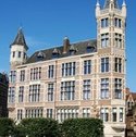
Natiënhuis, Jordaenskaai 25, 2000 Antwerpen
READING SUMMARIES

Climate change in the Scheldt District : the role of the International Scheldt Commission
Leon Dhaene, Secretary-General ISC - CIE
The International Scheldt Commission (ISC) is an intergovernmental organisation for the sustainable management of the International River Basin District of the Scheldt (including the affluents of the Scheldt, La Somme and Yser rivers, and the North Sea costal line between Ault in France and Zierikzee in the Netherlands). The ISC was created in 1994 by the governments of the French Republic, the Walloon Region, the Flemish Region, the Brussels Capital Region and the Kingdom of the Netherlands signing the Treaty of Charlesville Mezières on the protection of the Scheldt. The ISC overviews the implementation of the European Water Framework Directive, the Flood Directive, and the operations of the Scheldt Warning and Alarm System. As such, the organisation is directly in charge of the water reserves and quality of 13 million people. The impact of climate change on water management is huge. Increased temperatures increases drinking water consumption and lower the flow in the rivers, impacting groundwater reserves. Increased water temperatures impacts the water quality, the biodiversity, and invasive species in the rivers. Less rain and more thunderstorms will again reduce the groundwater reserves and will drain heavy water loads, because of the impermability of a vast part of our modern surfaces, directly to the rivers and the sea. Increasing sea level will represent challenges to the costal defence and impact the salinisation of groundwater. Stronger floods may create security issues for our society, but will also negatively impact the water quality in rivers, as it will draw waste into the water bodies. Pollution by agriculture, industry, or individuals impact the water quality, with new problem areas such as pesticides, perfluorinated substances, medical pollution, etc... Several years of continuous droughts reduces water levels in rivers and groundreserves, and impacts biodiversity, fishing mortality, and the quality of water in general. The Delegations have identified 6 key issues for the International Scheldt Commission to work on over the coming years : guarantee the quality of the surface water, manage the groundwater reserves, inform stakeholders (such as drinking water companies) and the general public about the challenges in water management, safeguard the costal areas from climate change impact, provide a good quantitative water management, and ensure governmental policies are lined with the water objectives.
La Commission internationale de l'Escaut (CIE - ISC)) est une organisation intergouvernementale chargée de la gestion durable du district hydrographique international de l'Escaut (comprenant les affluents de l’Escaut, La Somme et l’Yser, ainsi que de la ligne côtière de la mer du Nord entre Ault en France et Zierikzee. aux Pays-Bas). Le CSI a été créé en 1994 par les gouvernements de la République française, de la Région wallonne, de la Région flamande, de la Région de Bruxelles-Capitale et du Royaume des Pays-Bas signant le Traité de Charlesville Mezières sur la protection de l'Escaut. Le CSI supervise la mise en œuvre de la directive-cadre européenne sur l'eau, de la directive relative aux inondations et du fonctionnement du système d'alerte et d'alarme Scheldt. À ce titre, l’organisation est directement responsable des réserves d’eau et de la qualité de 13 millions de personnes. L'impact du changement climatique sur la gestion de l'eau est énorme. La hausse des températures diminue le débit dans les rivières, ce qui a un impact sur les réserves d'eau souterraine. L'augmentation de la température de l'eau a aussi un impact sur la qualité de l'eau, la biodiversité et les espèces envahissantes dans les rivières. Moins de pluie et plus d'orages réduiront à nouveau les réserves d'eau souterraine et draineront des charges d'eau lourdes, en raison de l'imperméabilité d'une grande partie de nos surfaces modernes, directement vers les rivières et la mer. L'élévation du niveau de la mer constituera un défi pour la défense côtière et aura un impact sur la salinisation des eaux souterraines. Des inondations plus fortes peuvent créer des problèmes de sécurité pour notre société, mais auront également un impact négatif sur la qualité de l'eau des rivières, car elles entraîneront des déchets dans les masses d'eau. La pollution par l'agriculture, l'industrie ou les individus affecte la qualité de l'eau, avec de nouvelles zones problématiques telles que les pesticides, les substances perfluorées, la pollution médicale, etc. et la qualité de l’eau en général. Les délégations ont identifié 6 questions clés sur lesquelles la Commission internationale de l'Escaut devrait travailler dans les années à venir: garantir la qualité des eaux de surface, gérer les réserves d'eau souterraine, informer les parties prenantes (telles que les sociétés de distribution d'eau potable) et le grand public des défis posés par gestion de l'eau, protéger les zones côtières de l'impact du changement climatique, assurer une bonne gestion quantitative de l'eau et veiller à ce que les politiques gouvernementales soient alignées sur les objectifs en matière d'eau.
1.Climate-environment-human interaction along the Scheldt valley at the Pleistocene-Holocene transition (ca. 13.000 till 6000 cal BP)
Prof. Philippe Crombé, department of archaeology, Ghent University, Sint-Pietersnieuwstraat 35, 9000 Gent; Philippe.crombe@ugent.be
The interdisciplinary study of the long-term dynamic relationship between climate change, ecosystem response, and subsequent human adaptation along the Scheldt basin at the transition from the last ice age to the current warm epoch, the Holocene, has been the main focus of research for the last three decades at Ghent University. This climatic transition is considered a good, though cooler paleoanalogue for the present-day climate warming. Temperatures rose with a mean speed of 0.17 °C per decade, from ca. 11°C till ca. 15°C in summer. As a result hunter-gatherers faced comparable environmental changes to those that we are facing today, such as glacier melting, rapid sea level rise, the migration or extinction of specific plants and animals, increasing forest fires, the lowering of the ground-water levels, etc. In this paper some aspects of human adaptation to these environmental changes will be discussed both along the Upper and Lower Scheldt valley.
During the warm interstadial of the Late Glacial (ca. 14,000-12,900 cal BP) the Scheldt basin was recolonized by hunter-gatherers, settling preferably along the dry banks of former shallow freshwater lakes and ponds.
During the following cold reversal, known as the Younger Dryas (ca. 12,900-11,600 cal BP), hunter-gatherers faced drastic environmental changes as nearly all freshwater lakes vanished, probably resulting in a population collapse. It is not until the start of the Holocene that huntergatherers were again attracted to the Scheldt basin, now preferably erecting their camp-sites along the dry river banks. Rapid sea level rise, which led to the inundation of the North Sea basin, probably triggered human migration and resource stress. During the middle Holocene sea level rise also affected the land, inducing increased landward tidal ingression between 7000 and 5000 cal BP. Synchronically hunter-gatherers increasingly depended on fish consumption, which led to the production of ceramic pottery for the processing of aquatic resources. Meanwhile the first domesticated animals (cattle) and plants (cereals) were gradually introduced into the Scheldt basin, initiating the transition towards an agro-pastoral way of life.
Interactie tussen klimaat-milieu-mens langs de Scheldevallei bij de overgang Pleistoceen-Holoceen (ca. 13,000 tot 6000 CAL BP)
De interdisciplinaire studie van de dynamische relatie op lange termijn tussen klimaatverandering, ecosysteem respons en daaropvolgende menselijke adaptatie langs het Schelde bekken bij de overgang van de laatste ijstijd naar het huidige warme tijdperk, het Holoceen was de belangrijkste focus van het onderzoek voor de laatste drie decennia aan de Universiteit Gent. Deze klimaattransitie wordt beschouwd als een goed, hoewel koeler paleoanaloog voor de huidige klimaatopwarming. De temperaturen stegen met een gemiddelde snelheid van 0,17 °c per decennium, van ca. 11 °C tot ca. 15 °c in de zomer. Als gevolg daarvan hebben hunter-Verzamel bedrijven te maken gehad met vergelijkbare veranderingen in het milieu van die waar we vandaag voor staan, zoals het smelten van glacie, het snel stijgenvan de zeespiegel, de migratie of het uitsterven van specifieke planten en dieren, het vergroten van bosbranden, het verlagen van de grondwater niveaus, enz. In dit document zal een aantal aspecten van de aanpassing van de mens aan deze veranderingen in het milieu worden besproken, zowel in de boven-als de onderste Scheldevallei. Tijdens de warme interstadial van het late glaciale (ca. 14000-12,500 CAL BP) werd het Scheldebekken opnieuw gekoloniseerd door jager-verzamelaars bij voorkeur aan de droge oevers van de voormalige ondiepe zoetwatermeren en vijvers. Tijdens de volgende koude omkering, bekend als de jongere Dryas (ca. 12,0000-11600 CAL BP), werden jager-verzamelaars geconfronteerd met drastische veranderingen in het milieu omdat bijna alle zoetwatermeren verdwenen , waarschijnlijk ten gevolge van sterke bevolkingstoename. Het is niet tot het begin van het Holoceen dat jager-verzamelaar weer aangetrokken werden tot het Schelde bekken, nu bij voorkeur hun kampplaatsen langs de droge oevers van de rivier. De snelle stijging van de zeespiegel die leidde tot de overstroming van het Noordzee bekken, veroorzaakte waarschijnlijk menselijke migratie en voedseltekort. Tijdens het midden Holoceen had de stijging van de zeespiegel ook invloed op het land, het verhoogde landinwaartse getij had een inwerking tussen 7000 en 5000 CAL BP. De jager-verzamelaar werd op dat ogenblik afhankelijker van visconsumptie, die de productie van keramisch aardewerk voor de verwerking van aquatische hulpbronnen in de hand werkte. Ondertussen werden de eerste gedomesticeerde dieren (runderen) en planten (granen) geleidelijk in het Schelde bekken geïntroduceerd, waarbij de overgang naar een agro-pastorale manier van leven werd geïnitieerd .
2. Wandelende dorpen en de flexibiliteit van landgebruik langsheen de Schelde, van de Middeleeuwen tot vandaag.
Prof Dr Tim Soens, UAntwerpen Departement Stadsgeschiedenis.
Kust- en rivierenlandschappen zijn voortdurend in verandering, en wat eens droog was kan plots binnen bereik van het water komen te liggen. Langsheen de Schelde en in de diepe wateren van de Westerschelde vinden we letterlijk 100-en verdronken en verlaten dorpen – denk aan Saeftinghe of Rilland. Vaak denken we dan aan dramatische scenes – de Bijbelse zondvloed die alles en iedereen verslond, maar dat is niet noodzakelijk zo: heel wat van die ‘verdronken’ dorpen, blijken bij nader inzien zorgvuldig ontmanteld en verplaatst te zijn. Een duurzame bewoning in het kust- en rivierengebied vergt een voortdurende adaptatie aan een dynamische omgeving, en mobiliteit van bewoning – het fenomeen van de ‘wandelende dorpen’ - is het ultieme voorbeeld van wat de Nederlandse waterstaatshistorica Petra Van Dam ‘de amfibische kust-samenleving noemt’. In deze presentatie gaan we dieper in op enkele ‘wandelende’ dorpen en steden uit de geschiedenis van Schelde en Noordzee, van Nattenhaasdonk aan de samenvloeiing van Rupel en Schelde tot Oostende aan de Kust. We stellen de vraag waarom steden en dorpen zich verplaatsten en hoe dit in zijn werk ging. Minstens even belangrijk is de vraag wanneer de praktijk van zich verplaatsende nederzettingen tot een einde kwam. Waarom verloor het kust- en rivierlandschap op een bepaald ogenblik de flexibiliteit om zich aan te passen aan de veranderende ecologische context? Of is dit een verkeerde voorstelling en zijn zowel de stabiliteit als de flexibiliteit van landgebruik het resultaat van maatschappelijke afwegingen en concrete economische en politieke keuzes?
Walking villages and the flexibility of land use along the Scheldt, from the Middle Ages till today.
Coastal and river landscapes are constantly changing, and what was once dry can suddenly come within reach of the water. Along the Scheldt and in the deep waters of the Westerschelde we find literally 100 and more drowned and deserted villages - think of Saeftinghe or Rilland. We often think of dramatic scenes - the Biblical flood that devoured everything and everyone, but that is not necessarily the case: many of those "drowned" villages, on closer inspection, appear to have been carefully dismantled and relocated. Sustainable habitation in the coastal and river area requires constant adaptation to a dynamic environment, and mobility of habitation - the phenomenon of 'walking villages' - is the ultimate example of what the Dutch water management historian Petra Van Dam' amphibious coastal society calls'. In this presentation we take a closer look at some "walking" villages and towns from the history of the Scheldt and North Sea, from Nattenhaasdonk at the confluence of Rupel and Scheldt to Ostend on the coast. We ask why cities and villages moved and how this happened. Equally important is the question of when the practice of relocating settlements came to an end. Why did the coastal and river landscape at some point lose the flexibility to adapt to the changing ecological context? Or is this a wrong idea and are both the stability and the flexibility of land use the result of social considerations and concrete economic and political choices?
3. Schorren doorgrond: schorherstel als nature based solution voor verbetering van de waterkwaliteit
Niels Van Putte Phd Departement Biologie Universiteit Antwerpen
Schorren zijn de begroeide gebieden naast getijdenrivieren, zoals de Schelde, die rond elk springtij twee maal per dag onder water lopen. Ze beschermen het achterliggende land tegen overstromingen en de bodems van deze schorren werken als een filter waardoor ze de waterkwaliteit van de rivier verbeteren. In de voorbije eeuwen zijn veel van deze schorren verloren gegaan door inpoldering en gebruik als landbouw- en industriegebied, met ernstige overstromingen en een slechte waterkwaliteit als gevolg. Om de ecosysteemdiensten van schorren terug te verkrijgen, worden meer en meer ingepolderde gebieden terug hersteld en gecontroleerd weer blootgesteld aan de getijden. Hoewel deze herstelde schorren een goede bescherming bieden tegen overstromingen, weten we niet of ze even goed bijdragen aan de verbetering van de waterkwaliteit. Onze studie toont aan dat door het voormalige landbouwgebruik, de bodem van de polders werd samengedrukt, waardoor poriën verdwenen. Deze bodem blijft samengedrukt wanneer het schor wordt hersteld, zodat water slecht door de bodem kan stromen en er maar weinig interactie is tussen het overstromingswater en de bodem. Deze interactie is echter cruciaal voor het aanleveren van opgelost silicium en verwijdering van stikstof en fosfor uit de river. In deze studie onderzoeken we enerzijds hoe de stroming van grondwater en nutriënten verschilt tussen een natuurlijk en een hersteld schor en anderzijds welke bodembewerkingen toegepast kunnen worden wanneer er nieuwe schorren aangelegd worden, om zo de doorstroming van grondwater te bevorderen.
Tidal marshes unraveled: tidal marsh restoration as a nature based solution for water quality improvement
Tidal marshes are the vegetated areas adjacent to tidal rivers, such als the Scheldt, which inundate twice every day around spring tides. They protect the hinterland from floodings and the soil of these marshes acts as a filter, improving the water quality in the river. In the past centuries, many of these tidal marshes were embanked and the land was used for agricultural or industrial purposes, resulting in severe floodings and a deteriorating water quality. To regain the ecosystem services of tidal marshes, an increasing number of these areas is now restored by reflooding the embanked areas in a controlled way. Although these restored marshes offer a good protection against storm surges, it is unclear whether they contribute to water quality improvement to the same extent as natural tidal marshes. Our study shows that the soil in these embanked areas is compacted as a result of the former agricultural land use, reducing the pore space. When the marsh is restored, this soil remains compacted, leading to reduced groundwater flow and an impaired interaction between the soil and the water. This interaction is crucial for the delivery of dissolved silica and removal of nitrogen and phosphorus. In this research, we investigate how groundwater and nutrient flow differs between a natural and a restored tidal marsh, and which soil amendments can be applied to newly restored tidal marshes to ameliorate the flow of groundwater.
4. Écrire l’histoire environnementale de la vallée du Haut-Escaut, un paysage hybride entre culture et nature.
Laetitia Deudon, Univerité de Valenciennes et de Montréal.
Nu de Scheldevallei centraal staat in belangrijke regionale projecten zoals het Seine-Scheldekanaal en het RAMSAR * -label, lijkt het interessant om de dynamiek van dit grensoverschrijdende, muterende grondgebied in de kijker te plaatsen door middel van een multidisciplinaire en geïntegreerde benadering van het grondgebied. Het doel is om de trajecten van de landschappen te reconstrueren, uitgaande van de studie van de installaties en activiteiten met betrekking tot het water met de hulp van een verscheidenheid aan bronnen (tekstueel, cartografisch, archeologisch) in een diachronisch perspectief. De valorisatie van de artistieke en literaire vormen, hefboom van de vernieuwing en reclassering van het industriële grondgebied in Henegouwen-Cambrésis, maakt het mogelijk om de geschiedenis en de verhalen van het grondgebied en ook de denkbeeldige, te vertellen ondersteund.
À l’heure où la vallée de l’Escaut s’inscrit au cœur d’importants projets de territoire comme le canal Seine-Nord Europe et la labellisation *RAMSAR, il paraît intéressant de mettre à l’honneur les dynamiques de ce territoire transfrontalier en pleine mutation, dans une approche pluridisciplinaire et intégrée au territoire. L’objectif est de reconstituer les trajectoires des paysages de la vallée, à partir de l’étude des aménagements et des activités liées à l’eau en utilisant une diversité de sources (textuelles, cartographiques, archéologiques) dans une perspective diachronique. La valorisation des formes artistiques et littéraires sur le territoire de l’Escaut, levier d’innovation et de requalification du territoire industriel dans le Hainaut-Cambrésis, permet de raconter l’Histoire et les histoires du territoire et de l’imaginaire fluvial avec l’apport des outils numériques et des nouvelles technologies.
5. ‘Duurzame havenontwikkeling in een veranderende omgeving’
Eric de Deckere, CSR Manager, Port of Antwerp & Sofie Coppens, Alfaport Voka
De economische activiteiten in de haven van Antwerpen groeien jaar na jaar. Deze economische groei past binnen de visie rond duurzame havenontwikkeling waarvoor de haven resoluut heeft gekozen. Als leidraad voor deze duurzame havenontwikkeling wordt gebruik gemaakt van de duurzame ontwikkelingsdoelstellingen (SDG’s) van de Verenigde Naties. SDG11 Sustainable Cities and Communities, SDG13 Climate Action en SDG14 Life Below Water zijn gekoppeld aan enkele grote uitdagingen waarmee de haven van Antwerpen vanwege zijn ligging aan het Schelde estuarium in een dichtbevolkte regio te maken heeft. Hoe gaat de haven hiermee om en op welke wijze probeert de haven een bijdrage te leveren om deze doelstellingen op lokaal niveau ook te realiseren? The economic activities in the port of Antwerp are growing year after year. This economic growth fits in with the vision on sustainable port development that the port has resolutely opted for. The sustainable development goals (SDGs) of the United Nations are used as guidance for this sustainable port development. SDG11 Sustainable Cities and Communities, SDG13 Climate Action and SDG14 Life Below Water are linked to a number of major challenges facing the port of Antwerp due to its location on the Scheldt estuary in a densely populated region. How does the port deal with this and how does the port try to contribute to achieving these objectives at the local level?
SPEAKERS - SPREKERS - LECTEURS
Leon Dhaene, Secretaris Generaal van de Internationale Scheldecommissie
Per 1 september 2019 volgt Leon Dhaene Arnould Lefébure op als Secretaris Generaal van de Internationale Scheldecommissie. Leon Dhaene heeft meer dan 35 jaar executive management ervaring in grote multinationals zoals MasterCard, Europay, Eurocard, en IBM, en was ook Algemeen Directeur van Leaseurope (de Europese Leasing en Car Rental federatie), Eurofinas (de Europese federatie van de gespecialiseerde bedrijven in consumentenkrediet), en N2FINANCE (een Europees network van consultants in betaalsystemen en financiële technologie). Als serial entrepreneur stond hij aan de wieg van verschillende nieuwe bedrijven. Hij was tevens adviseur voor de Europese Commissie, voor de Europese consumentenorganisatie, en verscheidene grote financiële groepen en investeerders. Als gepassioneerd verdediger van het milieu heeft hij in 1996 een bio-ecologisch project gerealiseerd, een combinatie van ecologisch verantwoorde bouwmaterialen met passieve en actieve zone-energie, op de principes van Feng Shui. Leon Dhaene is historicus van opleiding, waar hij de impact van de industrialisatie bestudeerde op de verhouding tussen stad en platteland inzonderheid de inpact van de industrialisatie op het platteland. Hij was een van de eerste historici in België die gebruikt maakte van computermodellen, gebaseerd op big data en statistical pattern recognition. Hij is woonachtig te Kruisem, aan de Schelde. Zijn expertise betreft het leiden en beheren van ondernemingen en organisaties, het voeren van complexe internationale onderhandelingen, en het ontwikkelen van oplossingen in teamverband.
Leon Dhaene succédera à Arnould Lefébure au poste de secrétaire général de la Commission internationale de l'Escaut à partir du 1er septembre 2019. Leon Dhaene a plus de 35 ans d’expérience dans la gestion de grandes multinationales telles que MasterCard, Europay, Eurocard et IBM. Il a également été directeur général de Leaseurope (Fédération européenne du leasing et de la location de voitures), Eurofinas crédit à la consommation) et NT2FINANCE (réseau européen de consultants en systèmes de paiement et technologie financière). En tant qu'entrepreneur, il est au berceau de diverses nouvelles entreprises. Il a également été conseiller de la Commission européenne, de l'organisation de consommateurs européenne et de plusieurs grands groupes financiers et investisseurs. Passionné de l'environnement, il a réalisé en 1996 un projet bioécologique associant des matériaux de construction éco-responsables à une énergie de zone passive et active, basé sur les principes du Feng Shui. . Il a également été conseiller de la Commission européenne, de l'organisation de consommateurs européenne et de plusieurs grands groupes financiers et investisseurs. Passionné de l'environnement, il a réalisé en 1996 un projet bioécologique associant des matériaux de construction respectueux de l'environnement à une énergie passive et active, basé sur les principes du Feng Shui. Leon Dhaene est historien de formation, où il a étudié l’impact de l’industrialisation sur les relations entre ville et campagne, en particulier l’impact de l’industrialisation sur les zones rurales. Il fut l'un des premiers historiens en Belgique à utiliser des modèles informatiques basés sur le Big Data et la reconnaissance de modèles statistiques. Il habite à Kruisem, sur l’Escaut. Son expertise comprend la gestion et la gestion de sociétés et d'organisations, la conduite de négociations internationales complexes et le développement de solutions dans un contexte d'équipe.
Professsor Crombé, U Gent : Departement Archeologie - Onderzoeksgroep (en) ARCHAEO – Archeologie- Onderzoeksfocus : oudheidkunde – Onderzoeksperiode : Prehistorie (steentijd) . Veldonderzoek Geografische en op kaarten gebaseerde enquêtes en naar de rol van rivieren tijdens de Laat Glaciale rekolonisatie van NW Europa: een multidisciplinaire evaluatie van Finaal-Paleolithische sites in de Scheldevallei (België) Een ander project is de archeologische benadering van vroege interacties tussen jager-verzamelaars en sedentaire voedselproducenten in West-Centraal-Afrika. interdisciplinaire studie van de lange-termijn-dynamische relatie tussen klimaatverandering, ecosysteemrespons en de daaropvolgende menselijke aanpassing langs het Scheldebekken, bij de overgang van de laatste ijstijd naar het huidige warme tijdperk, het Holoceen, was de belangrijkste focus van onderzoek voor de laatste drie decennia aan de Universiteit Gent. Deze klimatologische overgang wordt beschouwd als een goede, hoewel koelere paleo-analoog voor de huidige klimaatopwarming. Als gevolg daarvan werden jagers-verzamelaars geconfronteerd met vergelijkbare veranderingen in het milieu als die waarmee we vandaag worden geconfronteerd, zoals smelten van gletsjers, snelle zeespiegelstijging, de migratie of het uitsterven van specifieke planten en dieren, toenemende bosbranden, de verlaging van de grondwaterstanden , etc. In dit artikel worden enkele aspecten van menselijke aanpassing aan deze veranderingen in het milieu besproken, zowel langs de Boven- als de Benedenscheldevallei.
Professor Tim Soens, U Antwerpen, Hoofd Departement Stadsgeschiedenis U Antwerpen. Hij ontwikkelde een nieuwe onderzoekslijn over de milieu- en plattelandsgeschiedenis van verstedelijkte gemeenschappen (ENVIRHUS) binnen het Centrum voor stadsgeschiedenis van Antwerpen. Dit onderzoek richt zich op de milieu-impact van kapitalisme en urbanisatie op samenlevingen van vóór 1900, met behulp van vergelijkende studies die nagaan hoe verschillende sociale groepen omgingen met milieu-uitdagingen en schokken (zoals overstromingen, hongersnood, watertekort, tekort aan kunstmest ...) in een context van versnelde verstedelijking en overgang naar kapitalistische economieën. Speciale aandacht wordt besteed aan aanpassingsstrategieën die ontwikkeld werden door subgroepen (zoals kleine boeren of armen in de steden), en aan de interactie tussen macht, technologie en sociale en ecologische ongelijkheden. Het behoud van het culturele landschap en het landelijke erfgoed van het Vlaamse (voorsteden) platteland is een van zijn belangrijkste doelstellingen
Niels Van Putte is doctoraatsstudent Departement Biologie Universiteit Antwerpen Sinds zijn eerste veldbezoek aan schorren tijdens zijn bachelorstudie biologie was Niels gefascineerd door het dynamische karakter estuariene ecosystemen. In zijn masterproef ontdekte Niels dat historische agrarische bodemverdichting de bodemeigenschappen in herstelde schorren veranderde. Tijdens zijn promotieonderzoek aan de Universiteit Antwerpen, met de steun van het FWO, gaat hij dieper in op dit probleem en onderzoekt hij hoe deze veranderde bodemeigenschappen van invloed zijn op de grondwaterstroming en de verbetering van de waterkwaliteit.
Laetitia Deudon est étudiante en doctorat auprès de l’Université de Valenciennes et Montréal Doctorante en cotutelle internationale France-Québec à l’Université polytechnique des Hauts-deFrance (EA4343 CALHISTE) et à l’Université de Montréal (Quebec, Canada), Laëtitia Deudon est spécialiste de l’histoire environnementale et la géohistoire des milieux fluviaux et des zones humides dans la vallée du Haut-Escaut. Elle a écrit plusieurs articles sur l'histoire des aménagements hydrauliques et la gestion des inondations entre Cambrai, Valenciennes et Tournai, et travaille en collaboration avec plusieurs gestionnaires du territoire de l'Escaut (Parc naturel régional ScarpeEscaut, Syndicat mixte de l'Escaut, Valenciennes Métropole) dans une approche appliquée de la recherche afin d'intégrer les dimensions historiques et culturelles dans la gestion et la valorisation du territoire de l'Escaut.
Sofie Coppens werkt bij Alfaport Voka. Alfaport Voka is het platform van en voor ondernemingen en beroepsverenigingen uit de Antwerpse haven binnen Voka-Kamer van Koophandel AntwerpenWaasland. Alfaport- Voka streeft naar een toegankelijke, faciliterende, kostcompetitieve en duurzame Antwerpse haven met het oog op een duurzame verankering van tewerkstelling en toegevoegde waarde in de haven. Alfaport Voka ontstond op 1 januari 2014 uit de integratie van Alfaport Antwerpen, de federatie van havengebonden en logistieke ondernemingen in de haven, met Voka, Kamer van Koophandel Antwerpen-Waasland. Binnen Alfaport Voka behartigt Sofie Coppens de thema’s rond milieu en duurzaamheid. Voka is het grootste en meest nabije ondernemersnetwerk in Vlaanderen.
Eric de Deckere is CSR Manager within the Antwerp Port Authority which he joined in 2011. Initially he was working in the Environmental Department focusing on integrated water management in the port area and sustainability reporting for the port community. Eric coordinates an international IAPH-PIANC working group on sustainability reporting. What started as a sustainability reporting process became a transition process towards a more sustainable Port of Antwerp, a joined process of all private and public actors active in and around the port. Eric is one of the driving forces of the World Ports Sustainability Program of the IAPH and is involved in the Environmental Committee of PIANC and in Navigating a Changing Climate. In 2018 Eric was awarded as CSR-professional of the year in the category large companies in Belgium.He is linked to the University of Antwerp as a Professor focusing on Sustainable Sediment Management. Before he started working in the port, he was lecturer at the Institute for Environment and Sustainable Development of the University of Antwerp. Last two decades he was involved in a lot of national and international projects in North and South focusing on Integrated Water Management.
Programma – Program
8.30 h : reception and coffee
9.00 h : welkom door Stad Antwerpen - introductie door Leon Dhaene, Secretaris-Generaal Internationale Scheldecommissie - welcome
9.30 h : Klimaat, leefomgeving en menselijke interactie langs de Schelde in het Plestocene-Holcene transitie
Climate-environment-human interaction along the Scheldt valley at the Pleistocene-Holocene transition (ca. 13.000 till 6000 cal BP)
Prof. Philippe Crombé, department of archaeology, Ghent University
The interdisciplinary study of the long-term dynamic relationship between climate change, ecosystem response, and subsequent human adaptation along the Scheldt basin at the transition from the last ice age to the current warm epoch, the Holocene, has been the main focus of research for the last three decades at Ghent University. This climatic transition is considered a good, though cooler paleoanalogue for the present-day climate warming. As a result hunter-gatherers faced comparable environmental changes to those that we are facing today, such as glacier melting, rapid sea level rise, the migration or extinction of specific plants and animals, increasing forest fires, the lowering of the ground-water levels, etc. In this paper some aspects of human adaptation to these environmental changes will be discussed both along the Upper and Lower Scheldt valley.
10.00 u Wandelende dorpen en de flexibiliteit van landgebruik langsheen de Schelde, van de Middeleeuwen tot vandaag.
Walking villages and flexibel use of land along the Scheldt River from the Middel Ages till now.
Prof Dr Tim Soens Medieval and environmental history at the University of Antwerp
Professor Tim Soens developed a new research line on the Environmental and Rural History of
Urbanized Societies (ENVIRHUS) within the Centre for Urban History of Antwerp. This research focuses on the environmental impact of capitalism and urbanization on pre-1900 societies, using comparative analysis to question how different social groups coped with environmental challenges and shocks (floods, famine, water shortage, shortage of fertilizer…) in a context of accelerating urbanization and a transition to capitalist economies Special attention is paid to coping strategies developed by subaltern groups (for instance peasant smallholders or the urban poor), and on the interaction between power, technology and social-environmental inequalities.
Preserving the cultural landscape and rural heritage of the Flemish (suburbanized) countryside is one of his main targets.
10.30 u Schorren doorgrond: schorherstel gebaseerd op natuurlijke oplossingen voor de verbetering van de waterkwaliteit.
Tidal marshes unravelled: tidal marsh restoration as a nature based solution for water quality improvement”.
Niels Van Putte, Doctorandus, strategisch onderzoeker, Departement Biologie Universiteit
Antwerpen – Phd , University Antwerp
Tidal marhes are the vegetated areas adjacent to tidal rivers, such als the Scheldt, which inundate twice every day around spring tides. They protect the hinterland from floodings and the soil of these marshes acts as a filter, improving the water quality in the river. In the past centuries, many of these tidal marshes were embanked and the land was used for agricultural or industrial purposes, resulting in severe floodings and a deteriorating water quality. To regain the ecosystem services of tidal marshes, an increasing number of these areas is now restored by reflooding the embanked areas in a controlled way. Although these restored marshes offer a good protection against storm surges, it is unclear whether they contribute to water quality improvement to the same extent as natural tidal marshes. Our study shows that the soil in these embanked areas is compacted as a result of the former agricultural land use, reducing the pore space. When the marsh is restored, this soil remains compacted, leading to reduced groundwater flow and an impaired interaction between the soil and the water. This interaction is crucial for the delivery of dissolved silica and removal of nitrogen and phosphorus. In this research, we investigate how groundwater and nutrient flow differs between a natural and a restored tidal marsh, and which soil amendments can be applied to newly restored tidal marshes to ameliorate the flow of groundwater.
10.45 u De geschiedenis schrijven van het leefmilieu van de vallei van de Boven-Schelde : een hibride landschap tussen cultuur en natuur. Écrire l’histoire environnementale de la vallée du Haut-Escaut, un paysage hibride entre culture et nature.
Writing environmental history of the Upper Scheldt : an hybrid river system between nature and culture.
Laetitia Deudon, étudiante en doctorat, Université polytechnique des Hauts-de-France - laboratoire Calhiste /CRISS- Université de Montréal - FAS/FESP - département Histoire
At a time when the Scheldt Valley is the center of important regional projects such as the Seine-Nord Europe Canal and the RAMSAR * label, it seems interesting to highlight the dynamics of this cross-border muttering territory in a multidisciplinary and integrated approach. The objective is to reconstitute the trajectories of the valley landscapes, starting from the study of the installations and activities related to the water by using a diversity of sources (textual, cartographic, archaeological) in a diachronic perspective. The valorization of the artistic and literary forms on the Scheldt territory, lever of innovation and requalification of the industrial territory in the Hainaut-Cambrésis, makes it possible to tell the History and the stories of the territory and the imaginary river, with the support of digital tools and new technologies.
11.00 u : ‘Duurzame havenontwikkeling in een veranderende omgeving’ - 'Sustainable Port Development in a changing environment.'
Dr.ir. Eric de Deckere - CSR manager – CA/ST – Port of Antwerp
Prof Departement Technology for Integrated Water Management, Antwerp University.
11.30 u : receptie en netwerking
Professor Tim Soens, U Antwerpen, ontwikkelde een nieuwe onderzoekslijn over de milieu- en plattelandsgeschiedenis van verstedelijkte gemeenschappen (ENVIRHUS) binnen het Centrum voor stadsgeschiedenis van Antwerpen. Dit onderzoek richt zich op de milieu-impact van kapitalisme en urbanisatie op samenlevingen van vóór 1900, met behulp van vergelijkende studies die nagaan hoe verschillende sociale groepen omgingen met milieu-uitdagingen en schokken (zoals overstromingen, hongersnood, watertekort, tekort aan kunstmest ...) in een context van versnelde verstedelijking en overgang naar kapitalistische economieën. Speciale aandacht wordt besteed aan aanpassingsstrategieën die ontwikkeld werden door
subgroepen (zoals kleine boeren of armen in de steden), en aan de interactie tussen macht, technologie en sociale en ecologische ongelijkheden. Het behoud van het culturele landschap en het landelijke erfgoed van het Vlaamse (voorsteden) platteland is een van zijn belangrijkste doelstellingen.
Professsor Crombé, U Gent : De interdisciplinaire studie van de lange-termijn-dynamische relatie tussen klimaatverandering, ecosysteemrespons en de daaropvolgende menselijke aanpassing langs het Scheldebekken, bij de overgang van de laatste ijstijd naar het huidige warme tijdperk, het Holoceen, was de belangrijkste focus van onderzoek voor de laatste drie decennia aan de Universiteit Gent. Deze klimatologische overgang wordt beschouwd als een goede, hoewel koelere paleo-analoog voor de huidige klimaatopwarming. Als gevolg daarvan werden jagers-verzamelaars geconfronteerd met vergelijkbare veranderingen in het milieu als die waarmee we vandaag worden geconfronteerd, zoals smelten van gletsjers, snelle zeespiegelstijging, de migratie of het uitsterven van specifieke planten en dieren, toenemende bosbranden, de verlaging van de grondwaterstanden , etc. In dit artikel worden enkele aspecten van menselijke aanpassing aan deze veranderingen in het milieu besproken, zowel langs de Boven- als de Benedenscheldevallei.
Niels Van Putte U Antwerpen
Schorren zijn de begroeide gebieden naast getijdenrivieren, zoals de Schelde, die rond elk springtij twee maal per dag onder water lopen. Ze beschermen het achterliggende land tegen overstromingen en de bodems van deze schorren werken als een filter waardoor ze de waterkwaliteit van de rivier verbeteren. In de voorbije eeuwen zijn veel van deze schorren verloren gegaan door inpoldering en gebruik als landbouw- en industriegebied, met ernstige overstromingen en een slechte waterkwaliteit als gevolg. Om de ecosysteemdiensten van schorren terug te verkrijgen, worden meer en meer ingepolderde gebieden terug hersteld en gecontroleerd weer blootgesteld aan de getijden. Hoewel deze herstelde schorren een goede bescherming bieden tegen overstromingen, weten we niet of ze even goed bijdragen aan de verbetering van de waterkwaliteit. Onze studie toont aan dat door het voormalige landbouwgebruik, de bodem van de polders werd samengedrukt, waardoor poriën verdwenen. Deze bodem blijft samengedrukt wanneer het schor wordt hersteld, zodat water slecht door de bodem kan stromen en er maar weinig interactie is tussen het overstromingswater en de bodem. Deze interactie is echter cruciaal voor het aanleveren van opgelost silicium en verwijdering van stikstof en fosfor uit de river. In deze studie onderzoeken we enerzijds hoe de stroming van grondwater en nutriënten verschilt tussen een natuurlijk en een hersteld schor en anderzijds welke bodembewerkingen toegepast kunnen worden wanneer er nieuwe schorren aangelegd worden, om zo de doorstroming van grondwater te bevorderen.
Laetitia Deudon U Valenciennes en Montréal : Nu de Scheldevallei centraal staat in belangrijke regionale projecten zoals het Seine-Scheldekanaal en het RAMSAR * -label, lijkt het interessant om de dynamiek van dit grensoverschrijdende, muterende grondgebied in de kijker te plaatsen door middel van een multidisciplinaire en geïntegreerde benadering van het grondgebied. Het doel is om de trajecten van de landschappen te reconstrueren, uitgaande van de studie van de installaties en activiteiten met betrekking tot het water met de hulp van een verscheidenheid aan bronnen (tekstueel, cartografisch, archeologisch) in een diachronisch perspectief. De valorisatie van de artistieke en literaire vormen, hefboom van de vernieuwing en reclassering van het industriële grondgebied in Henegouwen-Cambrésis, maakt het mogelijk om de geschiedenis en de verhalen van het grondgebied en ook de denkbeeldige, te vertellen ondersteund
À l’heure où la vallée de l’Escaut s’inscrit au cœur d’importants projets de territoire comme le canal Seine-Nord Europe et la labellisation *RAMSAR, il paraît intéressant de mettre à l’honneur les dynamiques de ce territoire transfrontalier en pleine mutation, dans une approche pluridisciplinaire et intégrée au territoire. L’objectif est de reconstituer les trajectoires des paysages de la vallée, à partir de l’étude des aménagements et des activités liées à l’eau en utilisant une diversité de sources (textuelles, cartographiques, archéologiques) dans une perspective diachronique. La valorisation des formes artistiques et littéraires sur le territoire de l’Escaut, levier d’innovation et de requalification du territoire industriel dans le Hainaut-Cambrésis, permet de raconter l’Histoire et les histoires du territoire et de l’imaginaire fluvial avec l’apport des outils numériques et des nouvelles
technologies.
*the Ramsar Convention on Wetlands, (the intergovernmental treaty that provides the framework for the conservation and wise use of wetlands and their resources). This convention came into force in 1975.